
Boxing Day Walks Near Salcombe
5 Beautiful Boxing Day Walks Close to Salcombe
There’s no better way to burn-off your festive excesses than a hearty Boxing Day stroll. Fresh air, fabulous views, and gentle exercise provide a welcome remedy for all those Christmas Day indulgences.
Here are a handful of stunning Boxing Day walks around the picturesque seaside town of Salcombe, a popular sailors’ haunt famous for its maritime heritage and sparkling harbour.
Snapes Point (4 miles approx.)
A delightful walk on the fringes of Salcombe that provides stunning views of the estuary. Discover the tranquil backwaters of Batson Creek before following the weaving path around farmers’ fields. Across the water lies Southpool Creek and the sandy bays of East Portlemouth, and the gleaming ocean horizon beyond. Watch the sailing boats trim the tides around Salcombe Harbour, billowing their jibs into the ‘Bag’ (a well-known wend of the estuary). Keep your eyes peeled for cirl bunting, chiffchaffs and blackcap warblers, all of which inhabit the hedges and grassy slopes. Wading birds are a common sight along the creek, including red shank and oystercatchers, while sandpipers stilt their wiry trails along the tideline.
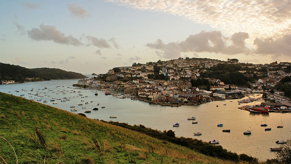
If you’re traveling to Salcombe by car, you’re best bet is to park up at Shadycombe Car Park and then pick up Gould Road, passing the boat park and crabbers’ quay en-route to Batson Creek. Walkers can enjoy two circular trails, a shorter two-mile stroll to Snapes Manor or a longer route that rounds Snapes Point. Quieter during the winter months, this walk remains ever-popular with bird lovers and dog walkers.
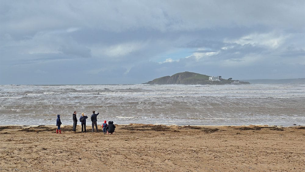
Salcombe to Soar Mill Cove (6 miles approx.)
A hearty circular walk along one of the South West Coast Path’s most beautiful stretches, contrasted by winding woodland trails.
Follow Cliff Road out of Salcombe, passing the ruins of Fort Charles Castle and South Sands Beach, to pick up the coastal path as it climbs around the craggy headland above Starehole Bay. You’ll be able to enjoy far-reaching views from Bolt Head, Dodman Point to the west and Prawle Point to the east. Continue along the coastal path to a flat sweep known as The Warren which lies above Little Goat cliffs. You’ll eventually encounter Soar Mill Cove, one of South Devon’s many secret beaches and smugglers’ coves, a beautiful sandy inlet sheltered by grassy bluffs peppered by sea beet, rock samphire and rare sea lavender. Keep your eyes peeled for cirl buntings, stonechats and seals bobbing in the bay.
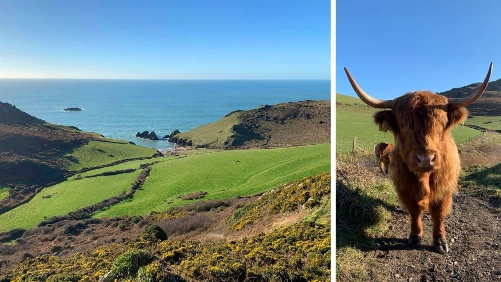
From here, you can follow the path inland to the pretty thatched cottage hamlet of Soar, walking through rolling green pastures to pick up the leafy track through Tor Woods to reconvene with the coastal path at Splatcove Point, above South Sands. This is a lovely walk for wildlife enthusiasts who enjoy regular sightings of dolphins, basking sharks and soaring buzzards – so be sure to pack your binoculars! The terrain is challenging in places, but the spectacular views are well worth the effort.
Mill Bay Walk to Gara Rock (4 miles approx.)
A much-loved looping walk around the coastal parish of East Portlemouth which lies across the waters of Salcombe harbour.
Set off from Mill Bay – one in a series of sandy coves that hugs the shoreline – and follow the waymarks to Gara Rock. As you round Rickham Common you’ll be treated to glorious views of the ruins of Salcombe Castle standing below the wooded hillside, the staggered rooftops of Salcombe in the distance. The South West Coast Path weaves its way past ancient pastureland and along Portlemouth Down, Prawle Point (Devon’s southernmost headland) easily spotted further east along the peninsula.
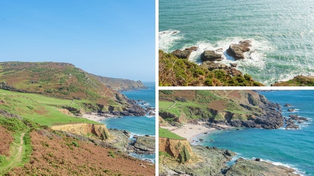
Below your trail, sheltered by the craggy cliffs and rocky juts, are a succession of lesser-known sandy inlets. Bear left at the first fork to follow the lower path above Rickham Sands, also known as Abraham’s Hole, a little golden bay revealed by the ebbing tide. Double back up the hill, past the Gara Rock Hotel, to find Rickham Lane and follow the lime trees back to Mill Bay car park. The Salcombe Ferry can be boarded at Salcombe’s Whitestrand Pontoon and the Jubilee Pier, making regular trips to and from East Portlemouth ferry slip.
Bolberry Down to Hope Cove (4.5 miles approx.)
A stunning walk with breathtaking views all the way to Bolt Tail before gentle strolls along the green and hedgy lanes of the pretty parish of Malborough.
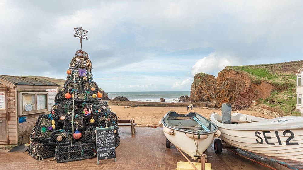
Set off from Bolberry Down, site of a World War II radar station, and follow the South West Coast Path as it snakes along the headland towards the historic fishing village of Hope Cove. This stretch of the path falls within a Site of Special Scientific Interest due to its precious flora and fauna. Keep your eyes peeled for sky larks, meadow pipits, cirl buntings and Dartford warblers. The rocky shores below were once perilous to mariners, ripping the bowels from many a ship and leaving the seabed scattered with wrecks. Bolt Tail was once the site of an Iron Age promontory fort, an archaeological monument dating back to 700 BC. Flint tools have been discovered here, believed to have been shaped and crafted during the Neolithic period.
With all this incredible history beneath your feet, it’s a marvellous place to sit amongst the pink sea thrift and admire one on the South Devon coast’s most cherished vantage points – Burgh Island and Thurlestone Rock both clearly visible to the west. Following the waymarks into Inner Hope, you’ll soon see the thatched fisherman’s cottages that help define this timeless, rural community. A footpath leads out of the village, across the rolling pastures and on to Sweethearts Lane, guiding you back to the National Trust Car Park at Bolberry Down…followed by a hot toddy back at your cosy holiday cottage.
Bantham to Thurlestone (3 miles approx.)
A revitalising teardrop walk from the golden sands of Bantham to the neighbouring village of Thurlestone taking in one of South Devon’s most treasured coastal corridors.
Begin your walk from Bantham Beach Car Park, where across the grassy dunes lies one of the West Country’s most iconic sandy bays and surf spots. Follow the South West Coast Path as it meanders upwards past the Long Stone and Butter Cove, skirting round Thurlestone Golf Course until you reach Warren Point which flanks Leas Foot Sands – the giant arch known as Thurlestone Rock visible in the distance. Pick up the metalled lane and follow it uphill, towards Thurlestone village, and continue past the lawn tennis courts. Hop over the stile just beyond the churchyard to convene with a track that runs adjacent to the golf course. Pass through the walkers’ gate to stroll across grassy meadows until you discover an uphill lane that will guide you back into Bantham, entering the village near The Sloop Inn, a 14th century hostelry in the heart of the community. This walk is sure to shake off your Christmas hangovers.
We hope you’ve found this walking guide useful. For more information and resources check out the following links: